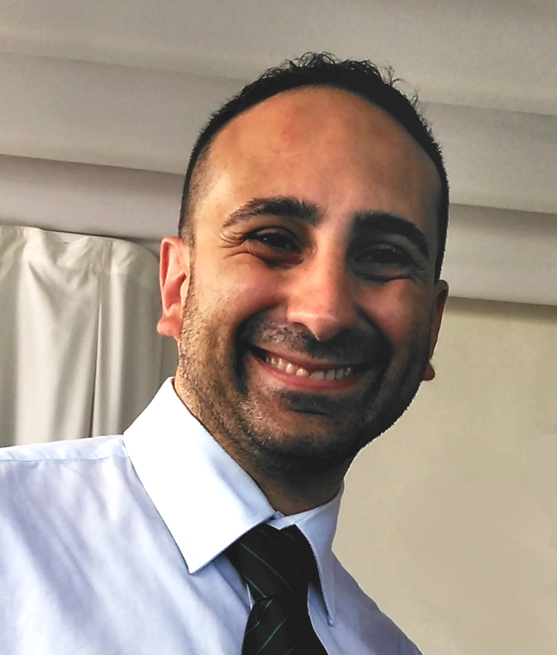
My name is Nicola De Innocentis, born in Naples, the 21st of April 1982.
I am a Telecommunication Engineer, skilled in Geographic Information System, Maps, geospatial data and certified basics in Remote Sensing.
Experience
- In 2011 I planned to create this blog , “Geopillole”, stands for “pills of geography” to show my works, made during all these years, through collaborations or personal projects, in which I was involved.
- During the same year, I took part in a project, named WA.R.M (WAter Resources Management), as GIS Analyst for EWB – Engineering Without Borders, with partners such as University of Naples Federico II, University of Salerno and University of Ouagadougou, Burkina Faso. The project dealt with Remote Sensing Images analysis from COSMO SKY MED satellite with aim to find solutions for the management of hydrological basins in North Burkina Faso. As GIS Analyst I produced different thematic maps obtained by classification techniques in a Open Source GIS environment as GRASS GIS. Some workshops about that subject were made for the project’s team.
- At same time, I contributed to CleaNAP association in environment, civil and social sphere. Actually the association performed cleaning actions in different Naples’ squares during the garbage emergency in 2011. Besides the participation to each performance, I was involved in the photo documentation and, later, in the release of two webGIS : CleaMAP and Vesti&Rivesti MAP.
- From 2012 to 2016 I worked abroad as Telecommunication Radio Engineer for an international telecommunication company NOKIA. Before in Lisbon, Portugal (+3 years) and then in Nozay, Ile de France, France (6 months) ( +details in Linkedin).
Thanks to that international experience I increase, not my professional expertises, but also my communication skills in different language such as English, Portuguese, French and Spanish (see some certificates below in Languages section). - During the abroad period, I’ve always continue to manage this website for publishing my posts and my works about Open Source GIS. For the love of Lisbon I dedicated a tourist guide, Vademecum Lisboa with several proposals of itineraries and a WebGIS named Montras de Lisboa about the old shops located in historical centre of Portuguese capital.
- On February, 2017, after being come back to Italy, I have been contracted by Synclab s.r.l., based in Naples as GIS Analyst. Consulting for Ericsson to analyze GAPs in GLOBAL GIS project, a cartographic service of ENEL (Colombia area) for monitoring power supply and tlc network ( +details in Linkedin).
- In 2017 Launch a Facebook page linked to Geopills blog with an increasing number of followers each day. The posts are not only about my articles but also all about geographic news and curiosities. The posts are regularly inserted on Linkedin personal activities.
- Launch web application SMAP, storymap to narrate.
- In 2018 I have been contracted by my currently company, Almaviva Digitaltec as GIS Specialist. I am involved for projects which provide digitalization to public sector, especially for web application where the geographic components is crucial ( +details in Linkedin).
- In 2020 launch of web application ColorMap, maps to paint made with OSM data and QGIS.
- On September,2020 collaboration with Storie di Napoli website, to build a web map called Storie di Napoli Map: a map which geolocate all published stories.
- On October, 2020 launch of AcquaMAT, a project powered by CleaNAP, based in Naples. It is creating a crowdsourced map of drinking water points scattered in all the cities of Europe, with the aim of promoting the use of public water, thus reducing the purchase of plastic bottles for water.
Education
I awarded my Master Degree in Telecommunication Engineering in 2009 with a thesis on Geographic Information Systems and Remote Sensing, named “Extraction of information from Remote Sensing Images by GIS techniques“. Since that moment, I began following all about Geography, Maps, GIS and webGIS Open Source world.
Courses
April, 2011 “GRASS GIS e lo scripting in Python”, lead by GfosServices Studio Associato (Certificate)
October, 2021 EO College – Echoes In Space – Introduction to Radar Remote Sensing (Certificate)
Conferences and Seminars
On September, 2015 participation to SASIG, Lisboa:
- Workshop Aquisição e Processamento de dados com UAV (Certificate)
- Workshop de Serviços de Dados Geograficos INSPIRE (GeoServer) (Certificate)
On November, 2017 I took part to GIS DAY 2017 in Naples as speaker to present the StoryMap “A fado story“, based on a historical path within centre of Lisbon.
On November, 2020 I took part to GIS DAY 2020 in Naples as speaker for presenting Acquamat project (Certificate).
On January, 2021 Speaker at Workshop “I GIS: metodologie e strumenti di supporto alle decisioni”,led by Ordine degli Ingegneri di Belluno for presenting Acquamat project.
In September, 2021 I took part to FOSS4G-IT Online Edition as speaker for presenting Acquamat project.
Publications
N. De Innocentis, B. De Innocentis, ”A Fado Story, una storymap per l’antico centro di Lisbona”, in “GIS DAY 2017: Il GIS per il governo e la gestione del territorio”, a cura di Barbara Cardone, Ferdinando Di Martino, Salvatore Sessa, Aracne Edizioni, Ottobre 2018, p. 3-21
E. Mellone, L. Calandriello, N. De Innocentis, ”A social mapping practice: AcquaMAT, as best practice”, in “GIS DAY 2020: Il GIS per il governo e la gestione del territorio”, a cura di Barbara Cardone, Ferdinando Di Martino, Aracne Edizioni, Novembre 2021, p. 175-186
Skill Keywords
GIS, Remote Sensing, Cartography, CSS, Earth Observation, Geographic Information Systems, Geography, GeoJSON, Geoserver, Geospatial Data, Geospatial Mapping, GIS Applications,Spatial Analysis, HTML, JavaScript, jQuery, JSON, Keyhole Markup Language (KML), LeafletJS, Linux, MySQL, Openlayers, Open Source GIS, OpenStreetMap, PHP, PostGIS, PostgreSQL, Postgresql Postgis, Python, Geopandas, QGIS, Radio Planning, SAR Processing, Satellite Data, Spatial Data Infrastructure (SDI), Telecommunication Engineering, WebGIS, Web Mapping


