
MDI – Mediterranean Desert Islands
MDI stands for Mediterranean Desert Islands, a map for all islands and islets whose main characteristic is that they are uninhabited or that human presence is or has been transient…. Read more »
MDI stands for Mediterranean Desert Islands, a map for all islands and islets whose main characteristic is that they are uninhabited or that human presence is or has been transient…. Read more »

Test to search and download Copernicus Sentinel data by using python library Sentinelsat.

fontanelle_quartieri Which are the main metrics for the project by using Geopandas, Folium , Matplotlib¶ Here more info about Acquamat, a crowdsourced map of drinking water spots scattered throughout all… Read more »

Overview about resampling theory for pixels upon an image, the principal steps for a corrected process and description on single techniques.
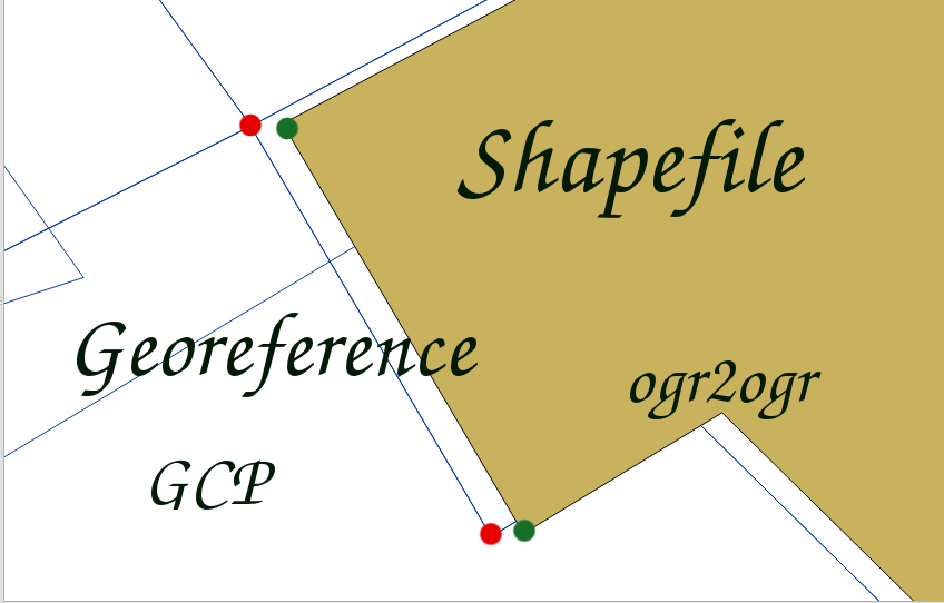
A short process in order to georeference any shapefile by terminal commands, using GDAL library ogr2ogr

A short introduction to the Leaflet library. A basic guidelines where we show the basic features for doing a proper webmapping.
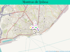
A map of Lisbon which shows and tells about the ancient shops in capital Portuguese’s centre. The map has been came along with several photos for showing the beautiful entries of each store.
![leafletmobile[1].jpg](https://www.nicoladeinnocentis.it/sito/wp-content/uploads/2017/12/leafletmobile1.jpg)
A fast example about the flexibility of Leaflet on mobile, playng with a plugin adapted to study case.
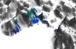
A QGIS guideline about the viewshed of a point on a digital elevation model and how it is possible to filter out points which doesn’t fall in line of sight (LOS)